Road safety
We utilized computer vision and street view images to identify essential road features.
Ref Data labeling and annotation- annotation
- object detection
- road safety
- street-view image
- CVAT
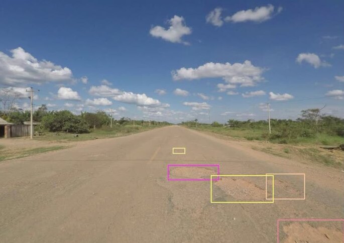
The objective of this project was to support the World Bank’s Road Safety program by utilizing computer vision and street view images to detect road features essential for conducting thorough safety audits and assessments.
We contributed to workflow design and imagery labeling. To achieve this, we conducted a thorough discovery process to identify and assess all relevant attributes for road safety evaluation, determining which could be reliably recognized and labeled in street-level images. The annotated road safety priority classes included painted lines, restricted medians, and potholes. For further details, please refer to our road safety class labeling guidelines.
For image sourcing, we utilized Mapillary to acquire street-view images along routes supplied by the World Bank. These routes spanned various countries and encompassed paved county roads, unpaved rural roads, and national roads.
Stats:
Among all the routes in different countries, we annotated around 5.7k images.
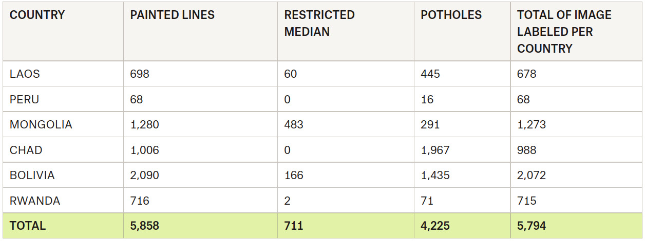 Statistics by country, classes, and total images