Commercial farms mapping in Ethiopia
We mapped more than 190 such farms in Ethiopia's lowlands.
Ref Rapid high-quality mapping- mapping
- commercial farm
- JOSM
- OSM
Agriculture stands as Ethiopia's primary economic activity, with smallholders cultivating approximately 37% of the nation's land, while large-scale commercial farms occupy 8%. These commercial farms contribute significantly to the production of various crops, including rice, maize, coffee, tea, cotton, pulses, rubber, and palm oil.
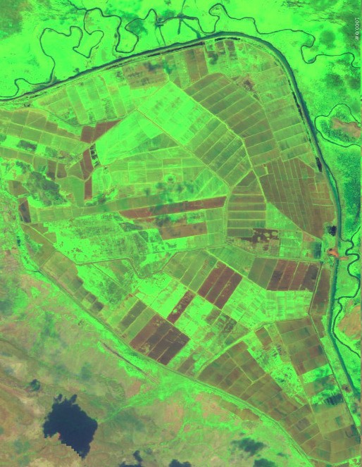
 Farmland in Ethiopia
Investment in agriculture emerges as a pivotal strategy for poverty alleviation in rural regions, constituting a cornerstone of Ethiopia's development agenda. To fortify this initiative, the Ethiopian government has prioritized attracting foreign investment into large-scale commercial agriculture. In alignment with these efforts, in collaboration with the World Bank and Development Seed, we undertook a large-scale commercial farm mapping project. Through this endeavor, we identified more than 190 such farms in Ethiopia's lowlands. These lowlands, typically defined as areas below 1,500 meters in altitude, encompass roughly 60% of Ethiopian territory and are home to 12% of its population.
Leveraging high-resolution satellite imagery from sources such as ESRI World Imagery and Sentinel-2 Agriculture mosaic, we accurately identified these large commercial farmlands.
 The total farms were added to OSM showing in green.
For further details on the methodology and documentation of large commercial farms, visit this link, and also check out the tool for visualizing farms and woredas with investors here.